
Mulmosog Mountain [Maol Mosog]
Good walks are even better shared.
Overview
Mulmosog Mountain [Maol Mosog]
Nestled in the breathtaking Scottish Highlands, Mulmosog Mountain, or Maol Mosog as the locals prefer, is a delightful Corbett offering stunning vistas and a plethora of hiking opportunities for adventurers of all skill levels.
Geology
The mountain boasts a geological backbone primarily made up of ancient Lewisian gneiss. This robust rock formation offers insights into the Earth’s history, shaped by intense tectonic activity millions of years ago. The rugged landscape is not just a treat for the eyes but a natural museum for geology enthusiasts.
Routes
One popular way to ascend Mulmosog is through the Glen Loin Approach. This 9 km moderately challenging route delivers a captivating experience through natural landscapes, presenting panoramic views as you ascend. Expect to spend around 3.5 hours on this delightful trek, making it ideal for a half-day hike. Don’t forget your sandwiches—hiking definitely works up an appetite!
Summit Features
At the summit, hikers are greeted by a large, classic cairn, a perfect spot to rest and reflect. Here, you can relish the panoramic views, as companions for many a hiker who have shared the same awe-inspiring sight.
Terrain
Expect a mix of rugged, grassy slopes with rocky outcrops, but do keep your eyes peeled for those pesky boggy patches that like to sneak up on you after a rainy spell!
Views
Once you reach the summit, you’ll be rewarded with breathtaking views of the surrounding peaks and valleys, including the shimmering waters of Loch Long. The best times to enjoy this visual feast are during spring and early autumn when the colours are vivid and the skies are clear. It’s a photographer’s dream!
Hazards
As with many Scottish peaks, be wary of rapid weather changes and always be prepared. The terrain can also be deceptively slippery in muddy sections, so sturdy footwear is a must—we wouldn’t want any embarrassing tumbles!
Nearby Summits
Mulmosog is not alone in its glory; it’s flanked by other beautiful hills such as Ben Ime and Beinn Narnain, which make for great additional hikes if you're up for an adventure!
Access
Reaching Mulmosog is fairly simple. The nearest parking area is at Glen Loin where you can leave your car. If you’re relying on public transport, consider hopping on a train to Arrochar and then a taxi for a short ride to the trailhead.
Facilities
Prior to hitting the trails, swing by Arrochar for a bite to eat. With its charming cafes and pubs, you’re sure not to go hungry before taking on the climb!
History
As for the name, 'Maol Mosog' translates to 'bare hill', which beautifully describes its rocky apex. The mountain is woven into the fabric of Highland culture, with stories of clans and their exploits firmly establishing its significance.
So lace up those boots, pack your rucksack, and experience the magic of Mulmosog Mountain for yourself. It’s a right good outing!
Happy hiking!
Explore routes near Mulmosog Mountain [Maol Mosog]
Public walks starting within 80 km of this hill. Nearby does not mean a route reaches the summit; check its map and access before setting out.
Florence Court: Riverside and Forest Circuit, County Fermanagh
View route
Derry~Londonderry City Walls Circuit
View route
Route planning notes
These notes describe possible approaches, not verified navigable routes or permission to cross land. Check current paths, local access rules and conditions before setting out.
Glen Loin Approach
A straightforward and scenic route starting from Glen Loin, following a well-trodden path leading towards the summit, perfect for all levels of hikers.
Make a day of it, together
Find someone to share the walk with, or organise a day out along a route you like.
Hill facts and local notes
Classifications
Elevation
351m
1,152 ft
Prominence
205m
Coordinates
54.7276, -8.4027
G741867
OS Map
10
At the Summit
The summit features a large cairn, a traditional Scottish landmark built from locally sourced stones. It offers a reliable place for hikers to rest and admire the vast views.
Terrain & Geology
Primarily composed of ancient Lewisian gneiss, Mulmosog Mountain showcases a range of geological formations that tell a tale of the Earth's tumultuous past. The rocks are weathered and rugged, offering a glimpse into the powerful forces that shaped this region over millions of years.
Views & Scenery
From the summit, you can observe the breathtaking peaks of the surrounding Highlands and the shimmering waters of Loch Long. On clear days, the views stretch as far as the Firth of Clyde.
History & Heritage
Name Origin
The name 'Maol Mosog' translates to 'bare hill' in Scots Gaelic, reflecting its rocky and exposed summit.
Historical Significance
The region is steeped in Highland folklore and history, with tales of clans and battles echoing through the valleys.
Getting There & Facilities
Check current local access restrictions, parking rules and transport timetables before travelling. These notes do not confirm public access to the summit.
Parking
There is a small parking area near the start of Glen Loin trailhead, accommodating several vehicles. Arrive early to secure a spot!
Public Transport
The nearest bus service to Glen Loin can be accessed from Arrochar, though service is limited. A train to Arrochar and Tarbet station followed by a short taxi drive is the most efficient method.
Nearby Facilities
Facilities in Arrochar include cafes, pubs, and public restrooms. It's advisable to fuel up before you head up the hill!
Safety Information
Known Hazards
- Beware of sudden weather changes; conditions can shift rapidly in the Highlands. Additionally, sections of the trail can be boggy and slippery, especially after rain.
General Safety Tips
- Check weather conditions before setting out
- Carry appropriate clothing and equipment
- Let someone know your planned route
- Take a map, compass, and GPS device
- Carry emergency supplies: food, water, first aid kit, torch
Hills
Some common questions about the hills answered
Are there group walks up Mulmosog Mountain [Maol Mosog]?
Many walkers use Walkmates to join or organise walks with others. You can check for group walks around Mulmosog Mountain [Maol Mosog] through the maps
Are there other walkers around Mulmosog Mountain [Maol Mosog]?
Activity varies by location and time, but Walkmates lets you see whether others have shared walks or shown interest in this area. Find other people through the walking friends search walking friends for Mulmosog Mountain [Maol Mosog] search or of course create your own walk for Mulmosog Mountain [Maol Mosog]
Can I organise a walk to Mulmosog Mountain [Maol Mosog]?
Yes. If there aren’t any walks listed already, you can create a walk and make it available for others to join.
If you're signed up to Walkmates, you can create a walk to Mulmosog Mountain [Maol Mosog].
How do I find a walk up this hill?
There are often multiple ways to walk this hill, depending on experience and route preference. Walkmates helps you explore walks and routes that others have shared.
Can I suggest a new route up Mulmosog Mountain [Maol Mosog]?
Yes. You can suggest or create routes to share with others. Walkmates focuses on the social side of walking, so routes are used to help people organise walks and explore areas together, rather than as detailed navigation tools or route libraries.
Other uses really appreciate knowledgeable walkers sharing their routes. Share your favourite route to Mulmosog Mountain [Maol Mosog] here
The is an error or something incorrect about this hill. How do I let you know?
We always strive to keep the information on Walkmates as accurate as possible. If you find an error, please let us know through the contact form and we'll aim to correct it as quickly as possible
Community Discussion
Comments
Location
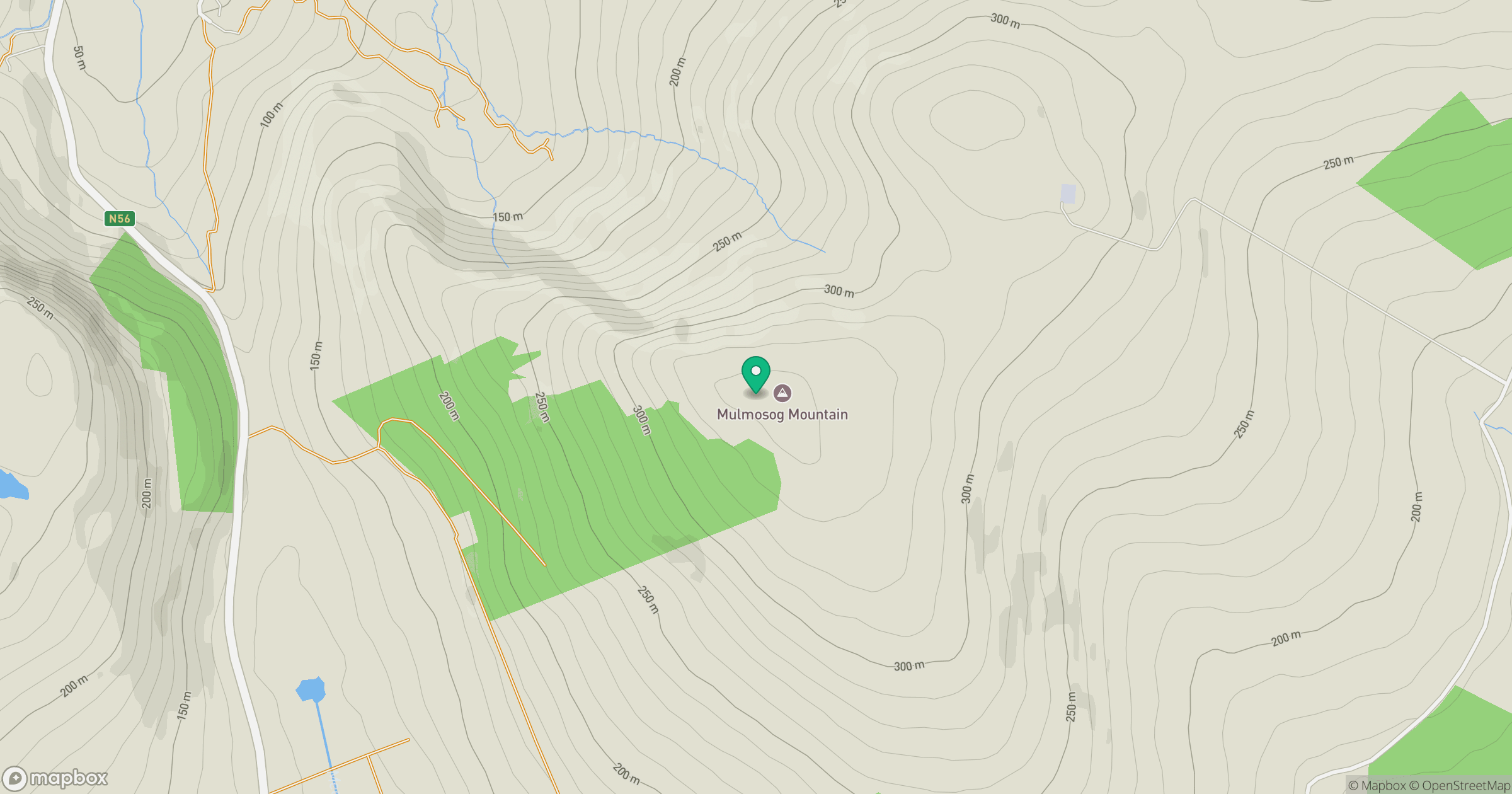
Grid reference: G741867
View on OpenStreetMapOpens a map in a new tab, centred on the hill.
Hills within 30 km
Straight-line distance, not a walking route or confirmation of access.
No comments yet. Be the first.